We drove the rough, muddy, bumpy road out of Ecuador and camped along a river just before the border. We had good company for the night, as we shared dinner with Baru (the dog) and his friend from Colombia. They are traveling on a motorcycle with a small trailer. The next day we all headed for the border offices. These offices were the most remote and non-technical that we have encountered yet on this journey. Checking out of Ecuador required a signature in a huge log book and then the head guy had to make a call to the main office. Then we had to sit and wait for a call back from the main office, saying we were cleared to pass to Peru. Check out these photos.

Entering Peru was a little more like prior border crossing experiences. Computers, stamps, printed permits and such. Although it did include a hassle over vehicle insurance, which we did not yet have for Peru. It seems that it is not sold at the border, but the police between there and the next town were supposedly lined up to pull us over and collect a fake fine for our infraction. We said we would take our chances, and it was all okay. No one stopped us and we safely made it to the first big town to purchase insurance. Maybe they were afraid of our giant “beauty and the beast” roaring past them at the checkpoints! 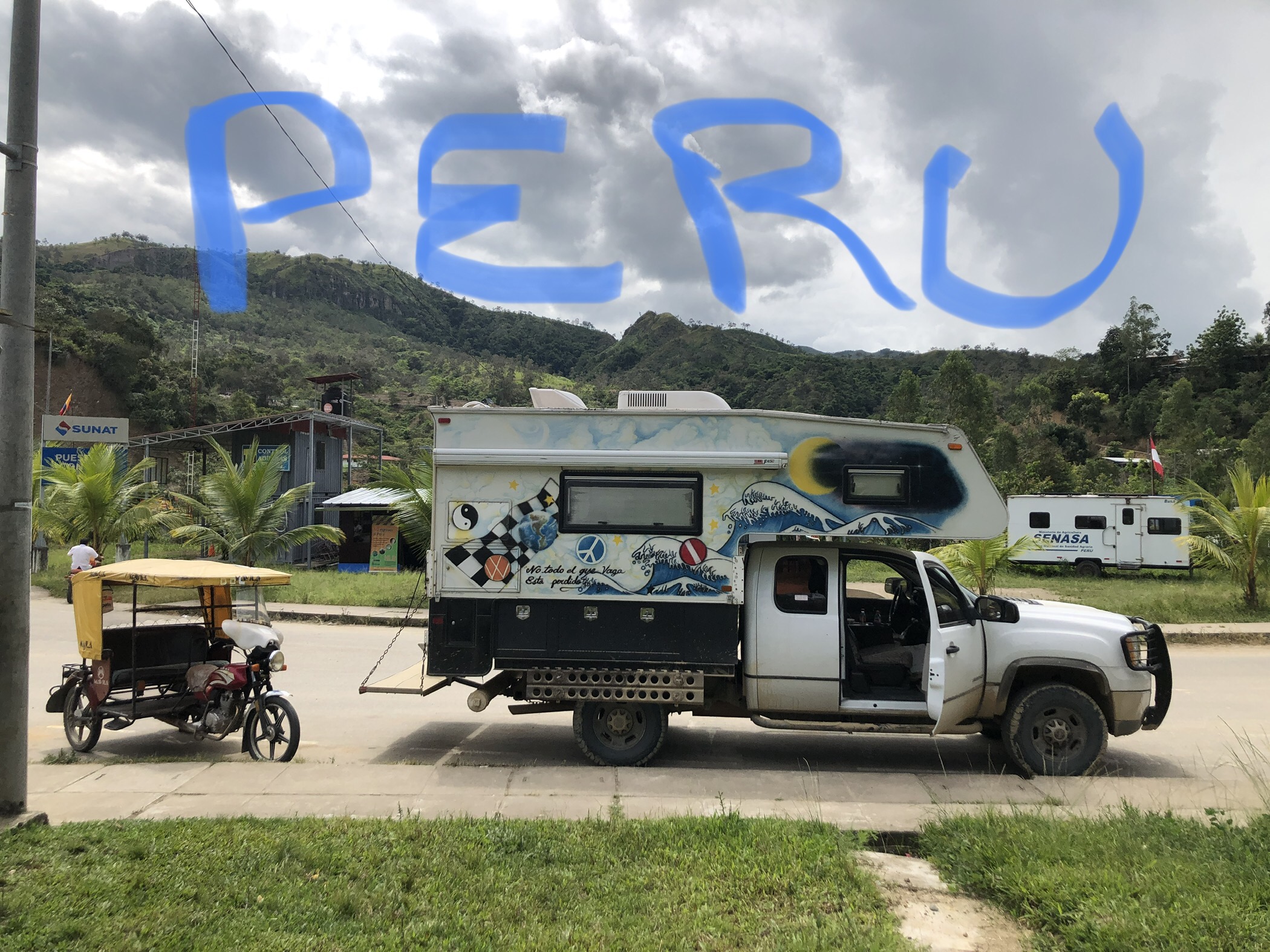
We spent a night at a riverside hot spring which doubled as a banana farm. The hot springs were swarming with mosquitos so we did not enter. But here are a couple of cool photos of bananas growing on the trees. To find the bananas, first you peer through the huge leaves of the banana tree to see the bunch hiding in there. Then you see the beautiful banana blossom hanging off the tree below the bananas. (then you are eaten up be mosquitos so you leave!) 

Gocta Falls was next on our list. Still moving through some of the Amazonas Region meant that we were in rainforest areas. The clouds moved around through the hills near us as we watched the falls. This perennial waterfall features two levels and a steady flow of water year-round. This is over 2,500 feet high and the roar of the water can be heard from far away. We decided not to try the muddy hike in the rain, but enjoyed the view, and the sound from a delicious bakery while sipping hot coffee and enjoying an adorable little bamboo bathroom.


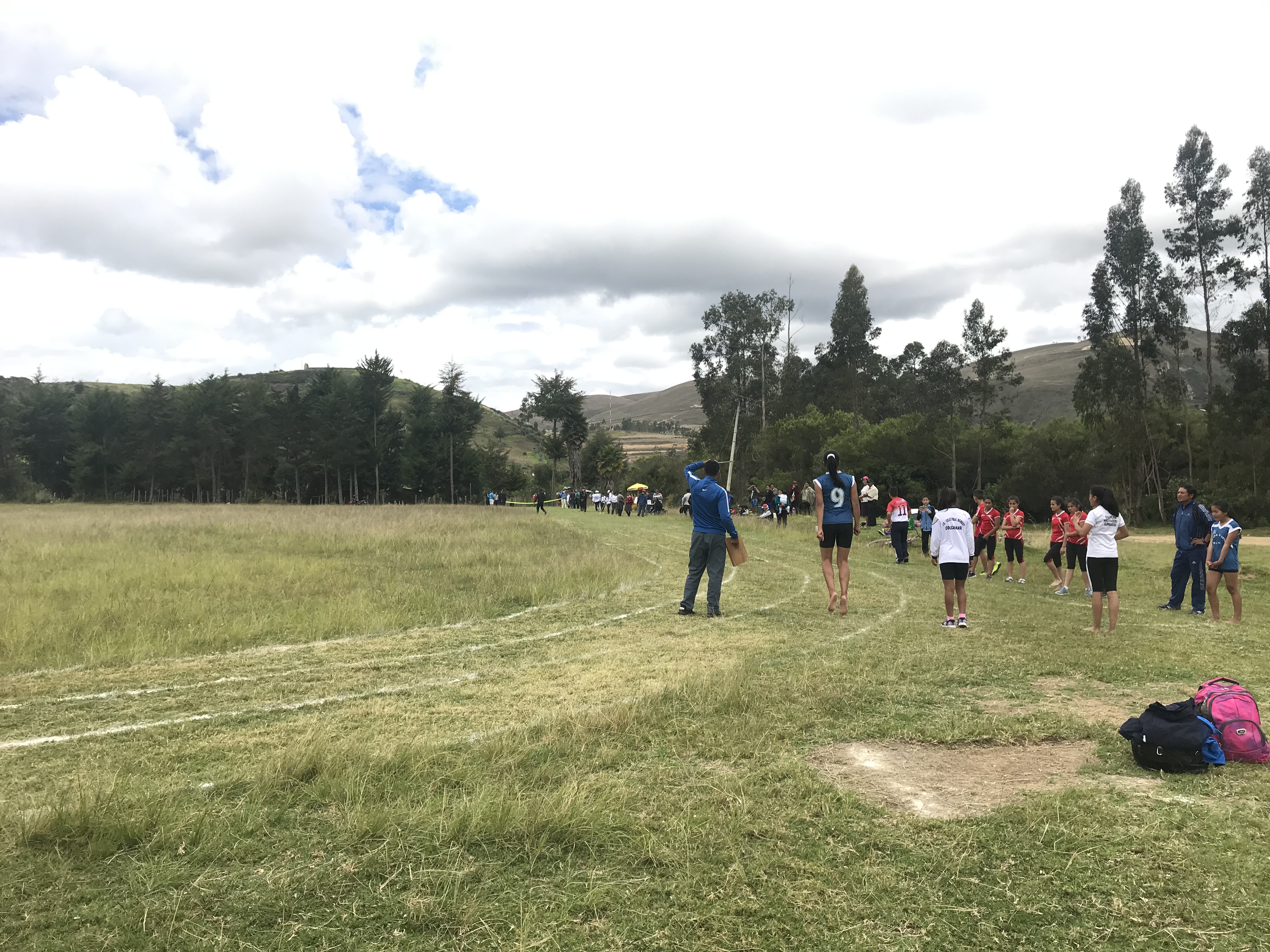
Not far from the waterfall area we found the city that was home to Pueblo Muertos. This archeological site looked interesting. As we arrived late, we set up camp on a large grassy field and went about our nightly routine of dinner, games, hot tea and sleep.  The next morning we awoke to a flurry of activity! The town was setting up the nearby flat area for a track meet. The lines were chalked by using plastic bags with holes in them, allowing a fine line of chalk to dribble out. The starting gun was two pieces of wood clapped loudly together. The various schools began to arrive and warm up for their events. And the athletes took the starting lines in a variety of footwear ranging from running shoes to socks to bare feet. It was fun to watch the school pride and sportsmanship.

 Luckily we had this to entertain us, as we learned that the archeology site was closed for repairs due to a landslide. So we packed up and moved on to see the Sarcophagi of Karajia just outside the little village of Karajia.
In this village we parked on the town square. On this particular day there was a town meeting taking place. Many women and men had gathered to fill out paperwork and talk with officials who arrived in a fancy car. We watched from our kitchen window. 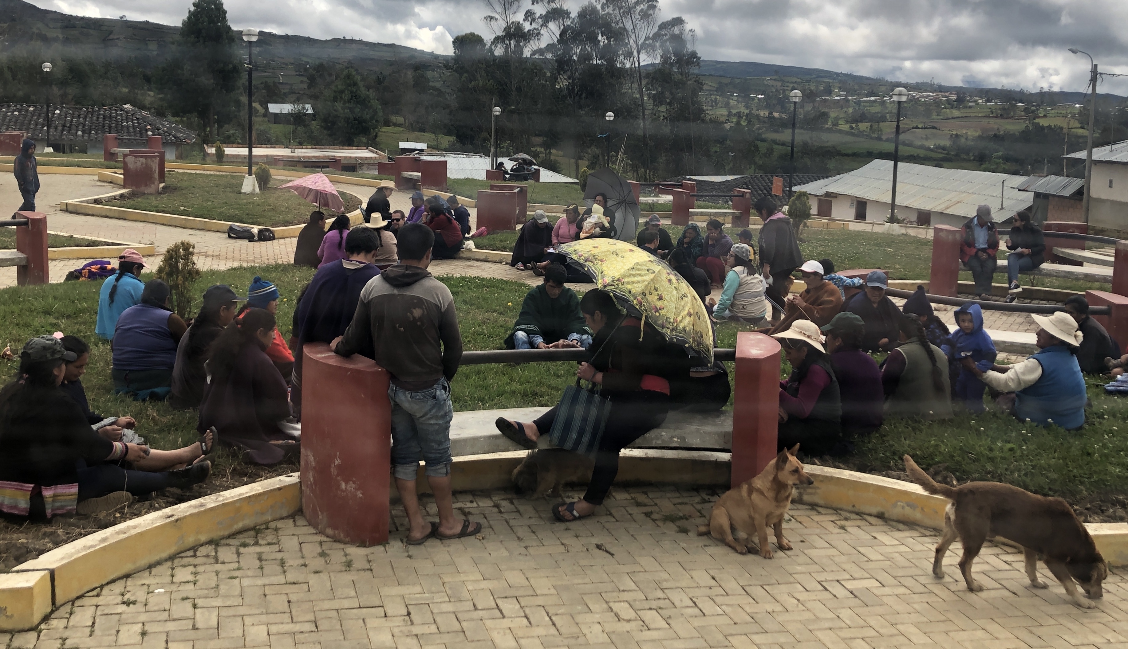
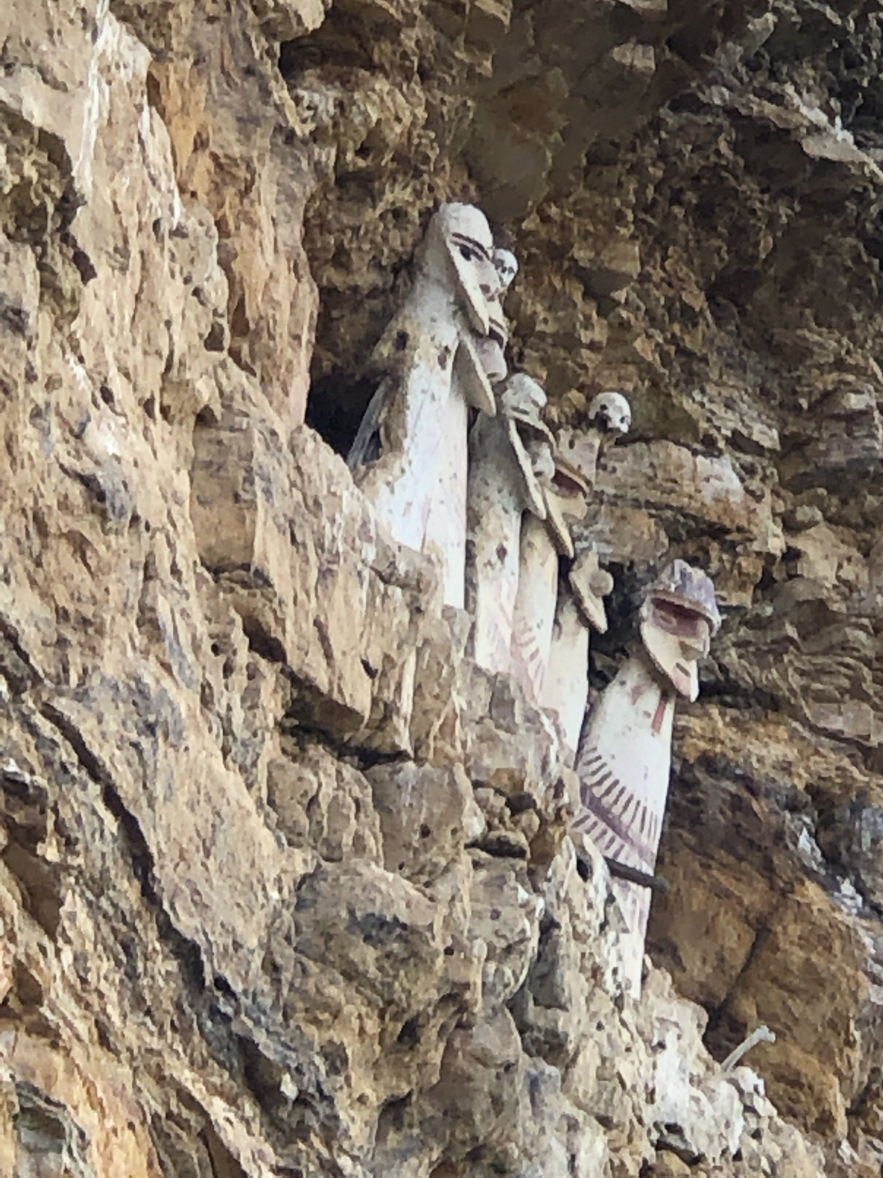
Then we took the hike to Karajia. The trail winds down and around a hill and through pastures. Then the view opened to a gorgeous valley and some sheer cliff walls. Suddenly, the wise men emerged from the rocks into our view. It takes a moment for your eyes to see them. In this selfie, you can just make out the sarcophagi to the left above Mike’s hat.  As we hiked closer the ceramic structures appear larger. They are actually about ten feet tall. At one time they housed mummies. But like much of the archeology in this region, they have been pillaged. When we began searching the cliff face with our eyes, we saw that several other ceramic structures remain, but none as impressive as these guys!


This is a good time to explain that Northern Peru has many, many archeological sites. More than they can reasonably manage. Many are in disrepair, have been looted or are inaccessible by road. Most of the ruins date to Pre-Incan times and represent the many cultures that were prominent in this area. While typical USA history books tell us much about the Inca people …… we must recognize that there were many, many more groups prior to the Spanish arriving and conquering the Inca.
Yes, the average history book simply begins the tale with the arrival of Europeans (Spanish) and the conquest of the continent. But before the Inca/Spanish conflict these groups were creating amazing facilities and incredible works of art. They were interacting, trading, sharing knowledge and worshipping their religious idols and gods. They had complex understandings of crop production, water management, mathematics and astronomy. But they did not have a written language as we know it. So the information that can be learned is based on symbolism, ceramics, textiles and guessing!
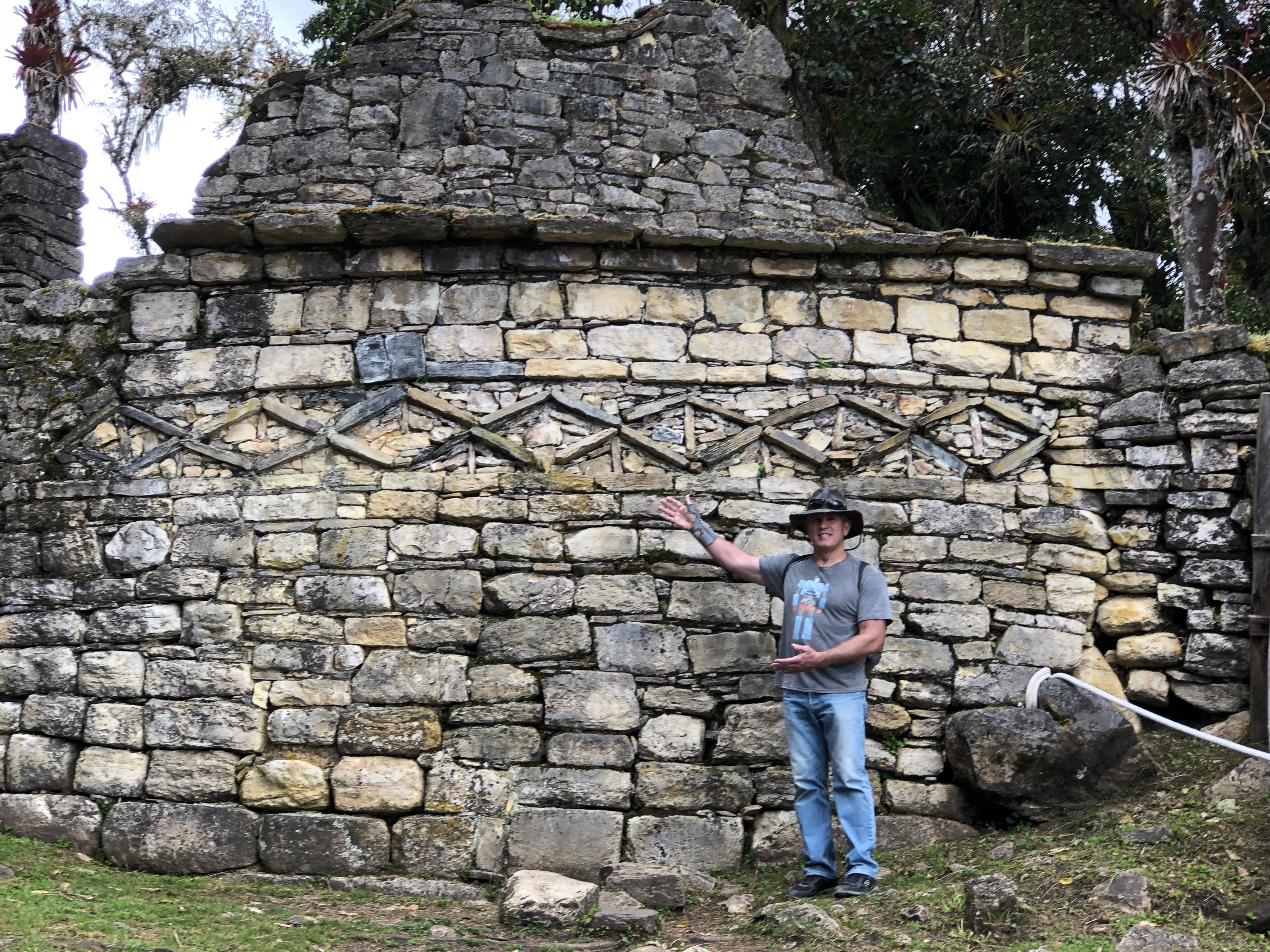
The next archeological site we visited in this region, Kuelap, is huge. It is often referred to as the Machu Picchu of the north. At one point this area housed over 300,000 people. But this was also abandoned after the conquest of the Spanish.  We had hoped to ride the aerial tram up to the top, but again, closed for maintenance. So we drove the long, dusty road to the top and camped with a gorgeous view of the ruins on the nearby ridge. In the morning we hiked the trail to the ruins and wandered among the stone structures.
  It was interesting to see that they are actively working to restore and maintain areas of Kuelap. There was much activity on one side, which prevented us from seeing some of the elaborately carved stones.
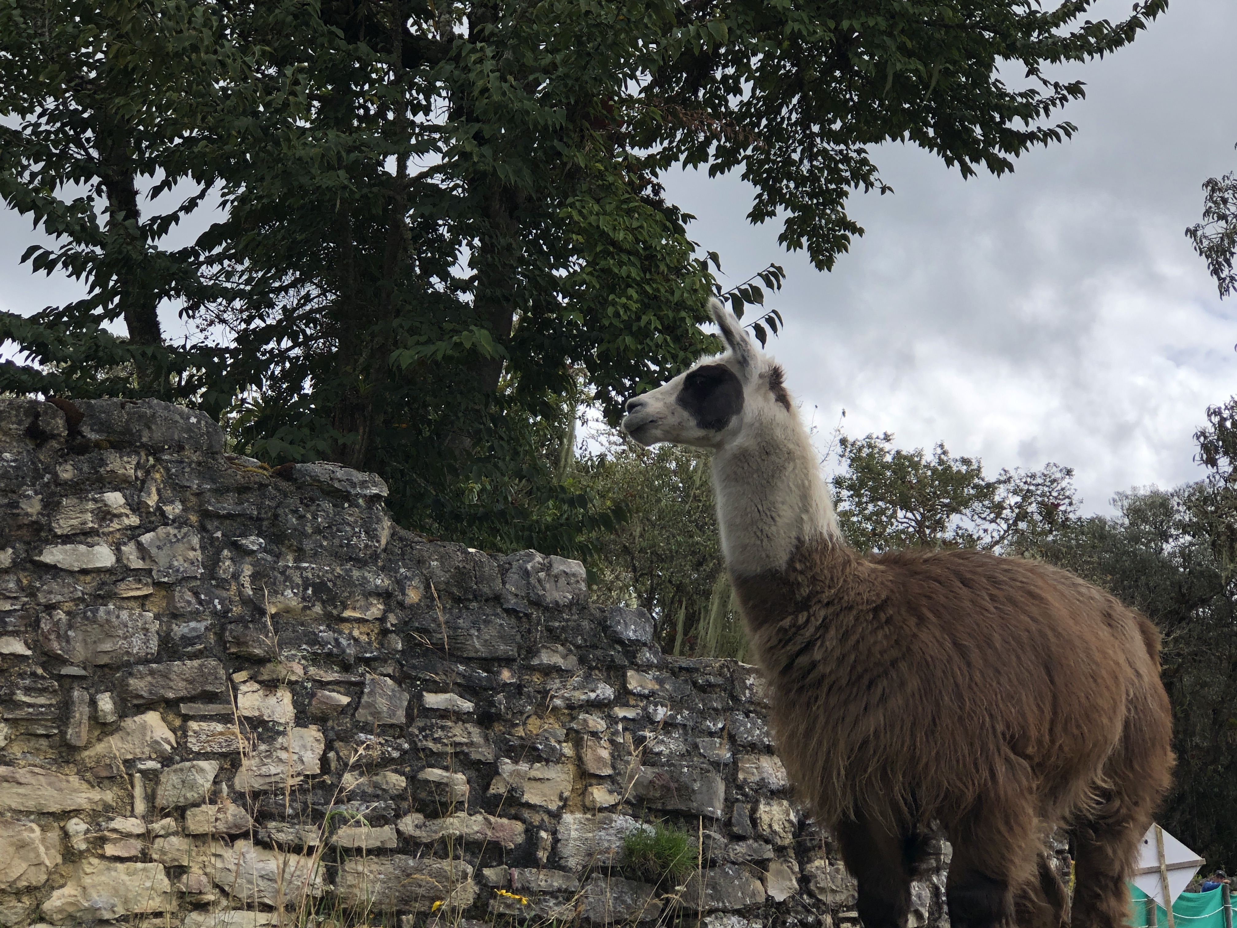
  But there was much more for us to explore including elaborate rock stacking designs in the walls and winding stairways. We even found a llama doing some basic landscaping among the rock ruins of Kuelap.


Things really started rocking and rolling for us after Kuelap. We found our way to the tiny village of San Bartolo and parked on the town square. As Mike stated, “This town is so small, we couldn’t spend money here if we tried.” There was no market, no restaurant, no shops. Just a handful of small, adobe homes and the ticket office for the trail to Revash. But before we share that amazing ruin, let’t talk about rocking and rolling. 
We awoke in the night to ask each other why we were moving around so much. But neither of us were tossing. We checked the dog, and she was asleep. Yet, we could feel the entire camper swaying and bouncing as if someone was jumping on the deck or pushing on the side. Then we became aware of the sounds outside and we looked out the roof hatch. Tiles were sliding off rooftops and crashing to the ground. Electrical lines were swinging like jump ropes as concrete power poles swayed back and forth. The four street lights in town were flickering on and off. Flashlights could be seen inside the crackling walls and windows of homes nearby. Yes, we were experiencing another earthquake. This one ended up as an 8.0 with an epicenter just about 175 miles from us. It was long and strong and we felt quite shaken by it. The next morning we observed the folks around us as they surveyed and repaired their damage. 
After our coffee and breakfast, we started out for the hike to view the ruins. We paid the fee (about $1.25) and took Nica along with us for the walk. The trail led us through the edge of the village and then overlooked amazing canyons, valleys and steep cliff walls. 
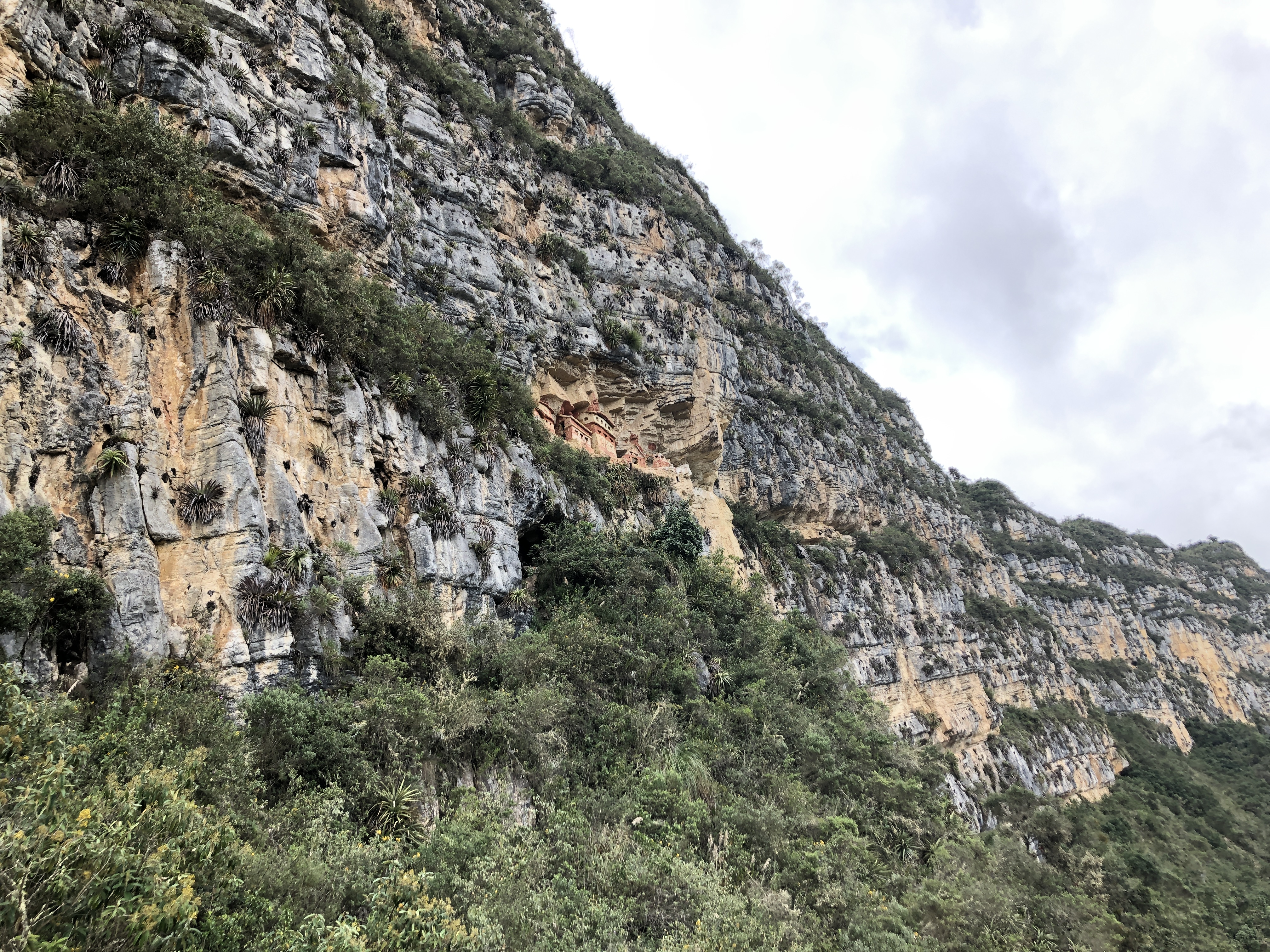
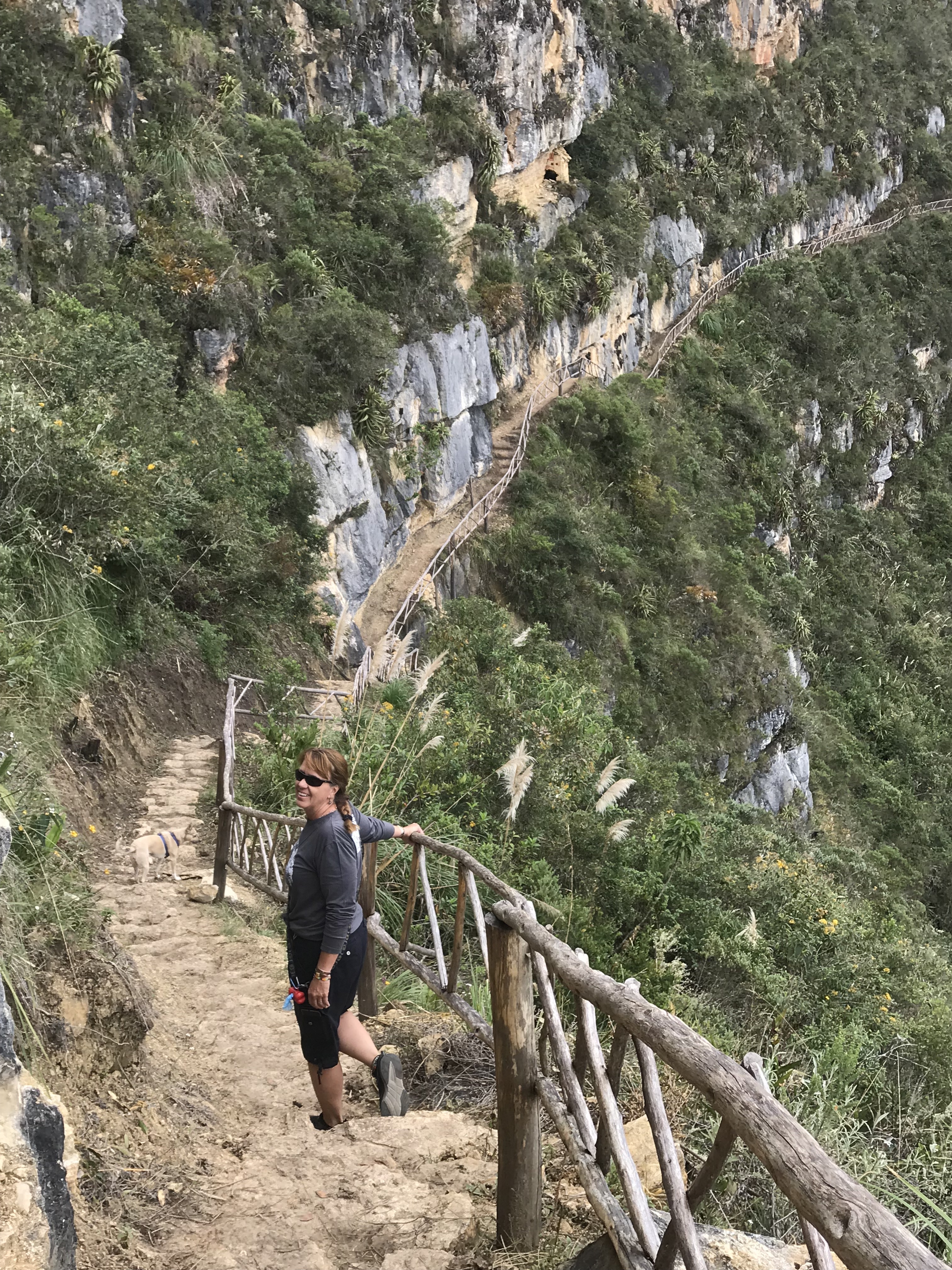 Then suddenly the ruins appeared in the cliff above us. Initially they looked small and insignificant. I could even hold them in my hand!
 But as we hiked closer we realized how large and extensive the ruins were. And the longer we gazed at the cliff wall, the more ruins began to emerge. This was an elaborate housing complex with various shapes and sizes of structures. Each one decorated differently and appearing to be used for different purposes. We were in awe as we looked up at these ancient, pre-Incan structures, preserved by their placement under the overhangs.


As we finished our exploration and drove out of this area, we looked back at the cliff walls we had been hiking along. With binoculars we could make out even more ruins than we originally spotted. And with our unaided eyes, we could not unsee the ruins of Revash tucked away in this amazing geological area. Look at the beauty of the shape of the earth in this area. Not hard to imagine why it was chosen as a sacred wall to house a mysterious group of ancient people. 
After a few nights in tiny villages and days of driving terrible, dusty or muddy dirt roads, we found the town of Leymabamba. We met some backpackers that needed a ride. We enjoyed a delicious dinner of traditional food with them. And we explored the famous museum of Leymabamba. This is the location of a fantastic, private collection of mummies and pre-Incan artifacts from this region of Peru. These mummies were collected from the nearby Lagoon of Los Condors (we did not visit there) as well as many undisclosed ruins (perhaps some that we shared above). This collection is said to be privately held in order to prevent the government from selling it off. It is a questionable situation, yet we enjoyed learning about the mummification process used in this region and viewing the extensive collection of mummies and artifacts on display. 


This would conclude our time in the Amazonas Region of Northern Peru. We were surprised by the quantity and quality of archeological ruins in these jungly mountains. We were also surprised by the poor quality of roads and infrastructure for the locals. Folks kept telling us that all the money is spent in the south, where the tourists flock to see Machu Picchu. From what we have seen here, those tourists are missing some amazing sights!
