Leaving the edge of the Amazon meant leaving the lush, wet jungle behind us. The surroundings started to change quickly.

We looked ahead on the map and realized we would be crossing the Andes on some rough, desolate dirt roads. The plants around us became smaller and smaller, quite different than the jungle area. Then suddenly the roads were dry and dusty! 
Steep hairpin turns on this dusty road. This climbs up and across the East side of the Andes in a section called the Cordillera Blanca.
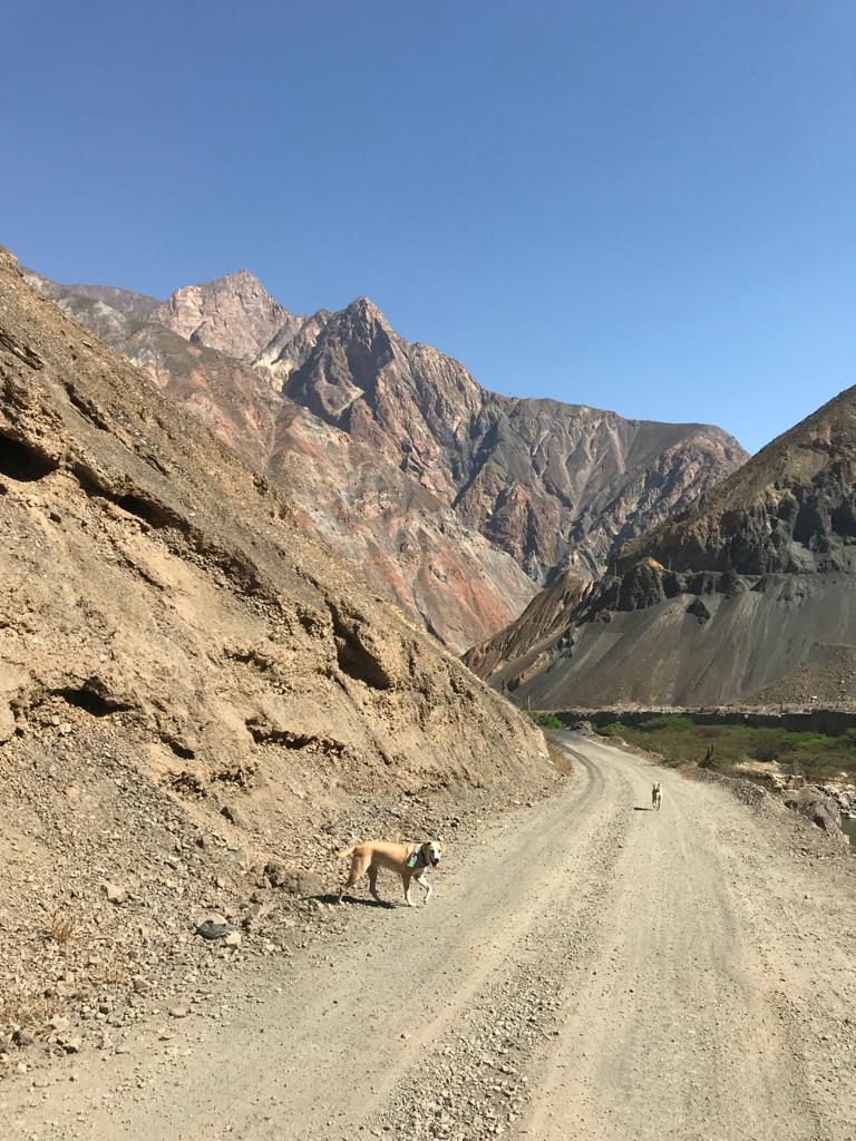

Some sections of the road are paved, but most are just dusty and dirty. But even those are only one lane wide. Soon we start to move closer to the “wet” side of the Andes. On the West side there is more water, humidity and fertile soil. In the distance you see some sections of green.

One of our favorite campsites was at the beginning of the agriculture zone. We found an old mining base of operations. Concrete slabs, a little creek, trails and views forever. These concrete slabs are covered in fancy tile, so at one time in history they likely had beautiful buildings on them. These mountains are filled with a deep and rich mining history, and much of it is not beautiful. Mining is currently a major political issue in Peru in several areas of the Amazon and the Andes. The poisoning of the people, the environment and the water is the basis of many protests. And the fact that most mines are owned and operated by foreign companies means that there is corruption and lack of concern throughout the industry. Yet it remains profitable and one of the largest employers in the nation. A struggle for the people of Peru, for sure.
(…….. climbs down off soap box to continue telling you about our travels ……)
As we continued along the West side of the Andes in Peru, we noticed the change in the landscape. There are two new features in this photo. The glacier and the lush agriculture. There is clearly ground water, fertile soil and the warmth of the sun to make this area productive for farming. 
We bumped along the rough roads and crossed through farms and fields. Then we reached our target and settled in to a campsite for the night near a roaring river. But the real attraction here were the services inside that building next to the camper! 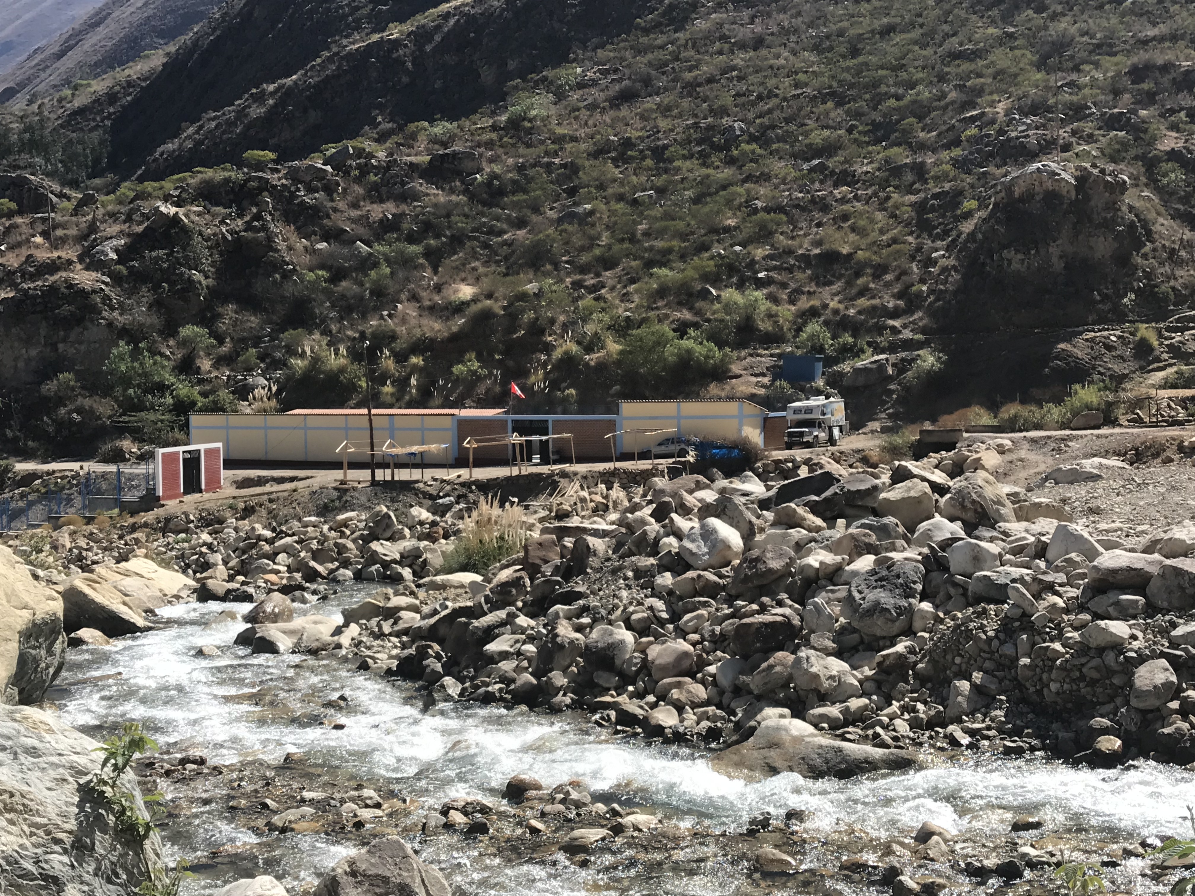 There they had built a series of concrete and tile rooms. Each room with a huge tub, ready to be filled by the natural hot spring water from the Andes. Entire families showed up to soak, bathe and socialize. We rented a private tub and enjoyed the hot bath ourselves!
 After a long, hot bath, Mike enjoyed a nap while Pacha enjoyed a snuggle with him! The next day we were relaxed, clean and ready to tackle the infamous Canyon del Pato. This section of road is well known for the numerous and lengthy tunnels. It is made dangerous by the narrowness of the single lane, two way road, made riskier by the sheer rock walls on one side and the river below the other side.


Other travelers had warned us of the dangers of oncoming traffic trying to pass. And the risk of a “Peruvian standoff” if you meet a bus in a dark tunnel. But we had no such adventure during this brief section of roadway. The risky section of road ends at a dam and generating station. Then we were on highway nearly as wide as two vehicles.  And suddenly as the road climbs up out of the sheer canyon walls you can begin to see the mountains in the distance It was there that we were greeted by the first views of the amazing, snow covered peaks of the Andes, in a section known as the Cordillera Blanca.
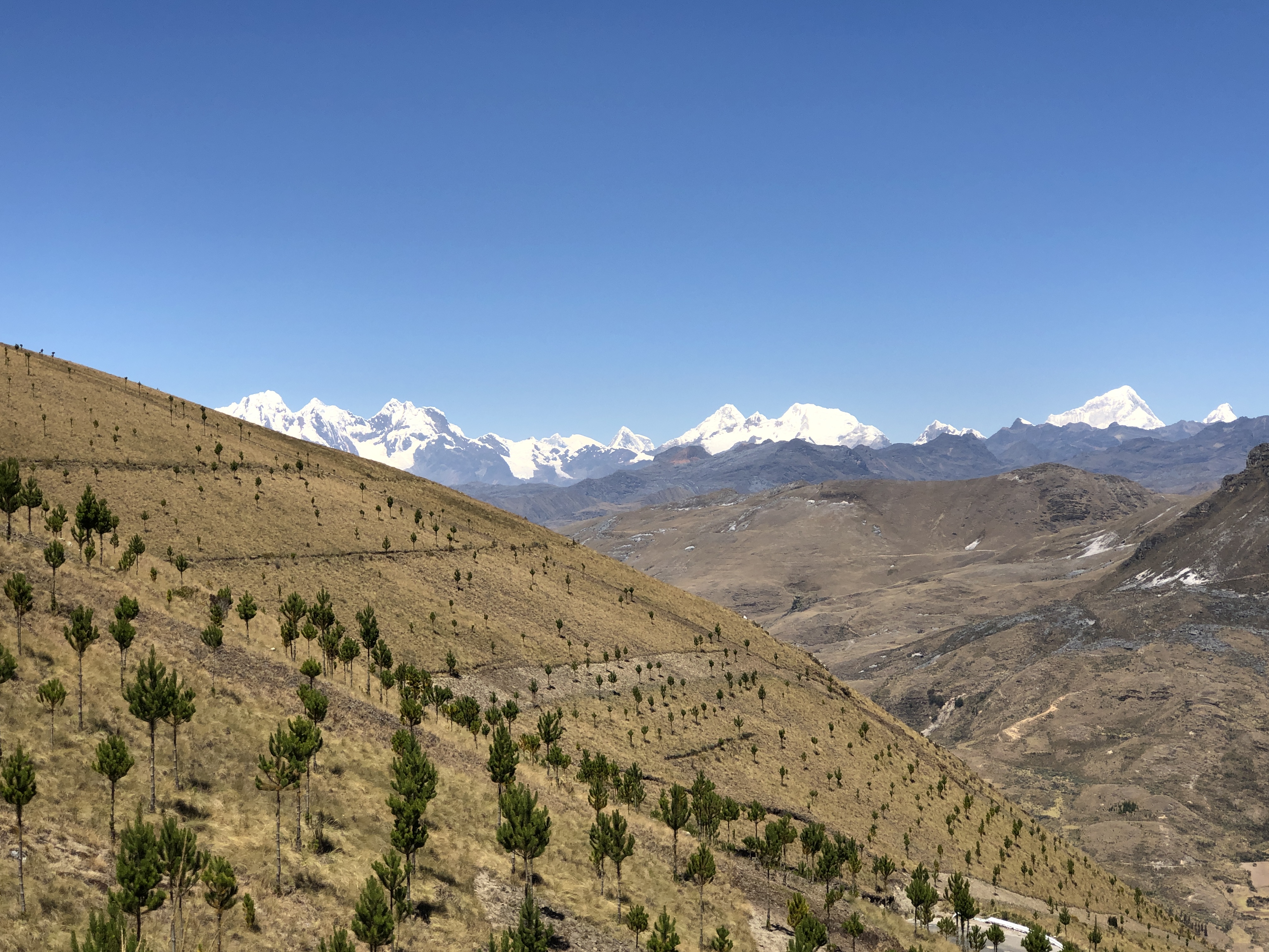
As we turned each corner and looked to our left, we saw a new view of the beautiful peaks in the distance. There were also many waterfalls inching their way toward the big rivers that lead to the sea. 
We continued to climb in elevation, and the plants began to change again. Things were spiky and dry with small leaves and hard coatings. There were many of these brightly colored bromeliads popping up through the rocky terrain and adding color to the scenery.  The higher we climbed in elevation, the more we noticed the changes in our surroundings. The most prominent feature was the rocky terrain all around us. Soil gave way to rocks of all sizes. Plants struggled for survival in the cracks and crevasses of the rocky hills. And the rocks around us were fractured and crumbly from years of freezing expanding water. There were entire areas of moraine, clearly left behind after the glaciers retreated to their present locations. And no doubt more to be revealed as the snow levels continue to change.

Looking back down the valley floor we could see the contrasts in the terrain very clearly. And in the center of the picture is a beautiful, glacier-blue stream. This is just a hint to the beauty that we are about to encounter.

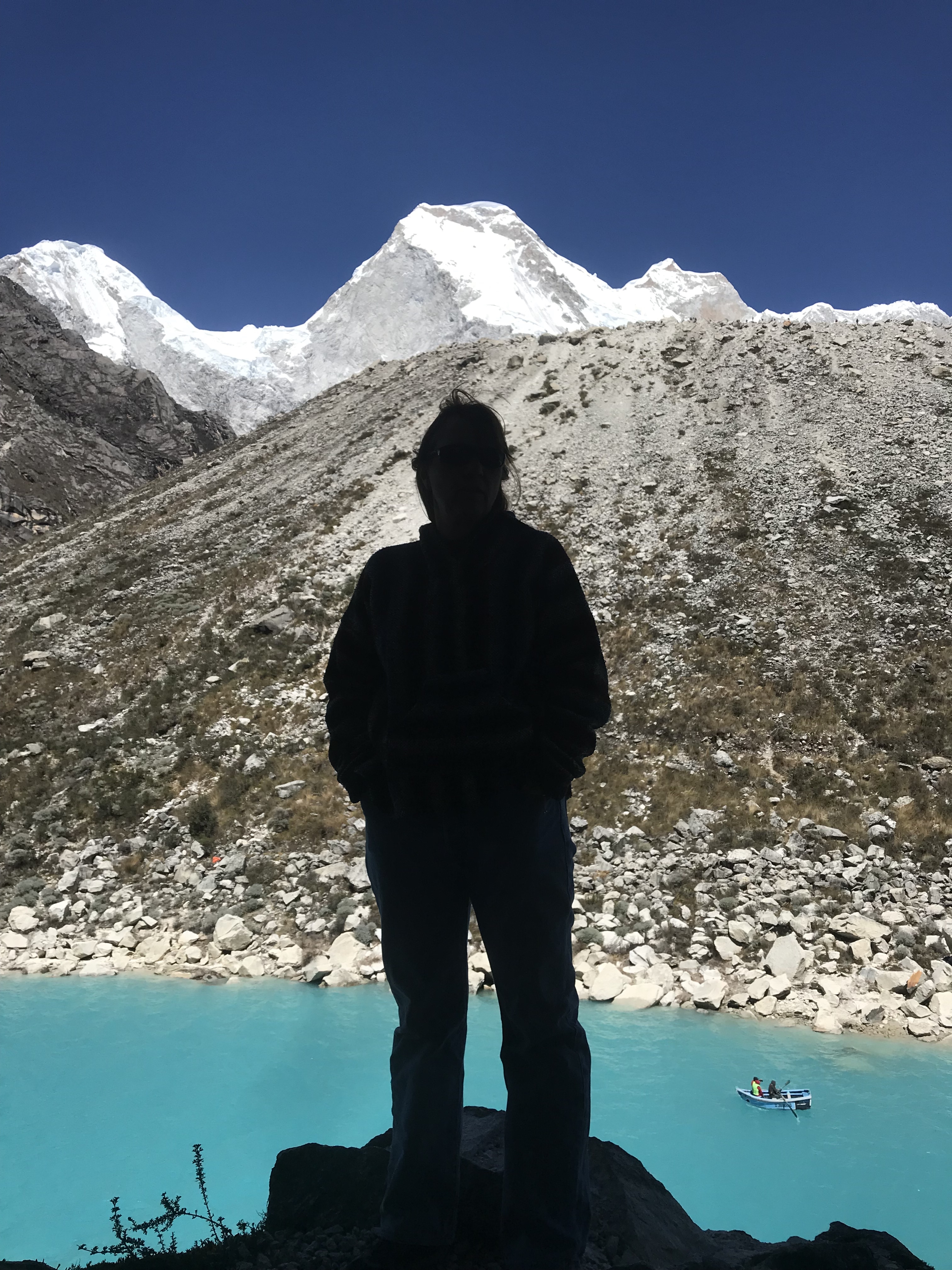
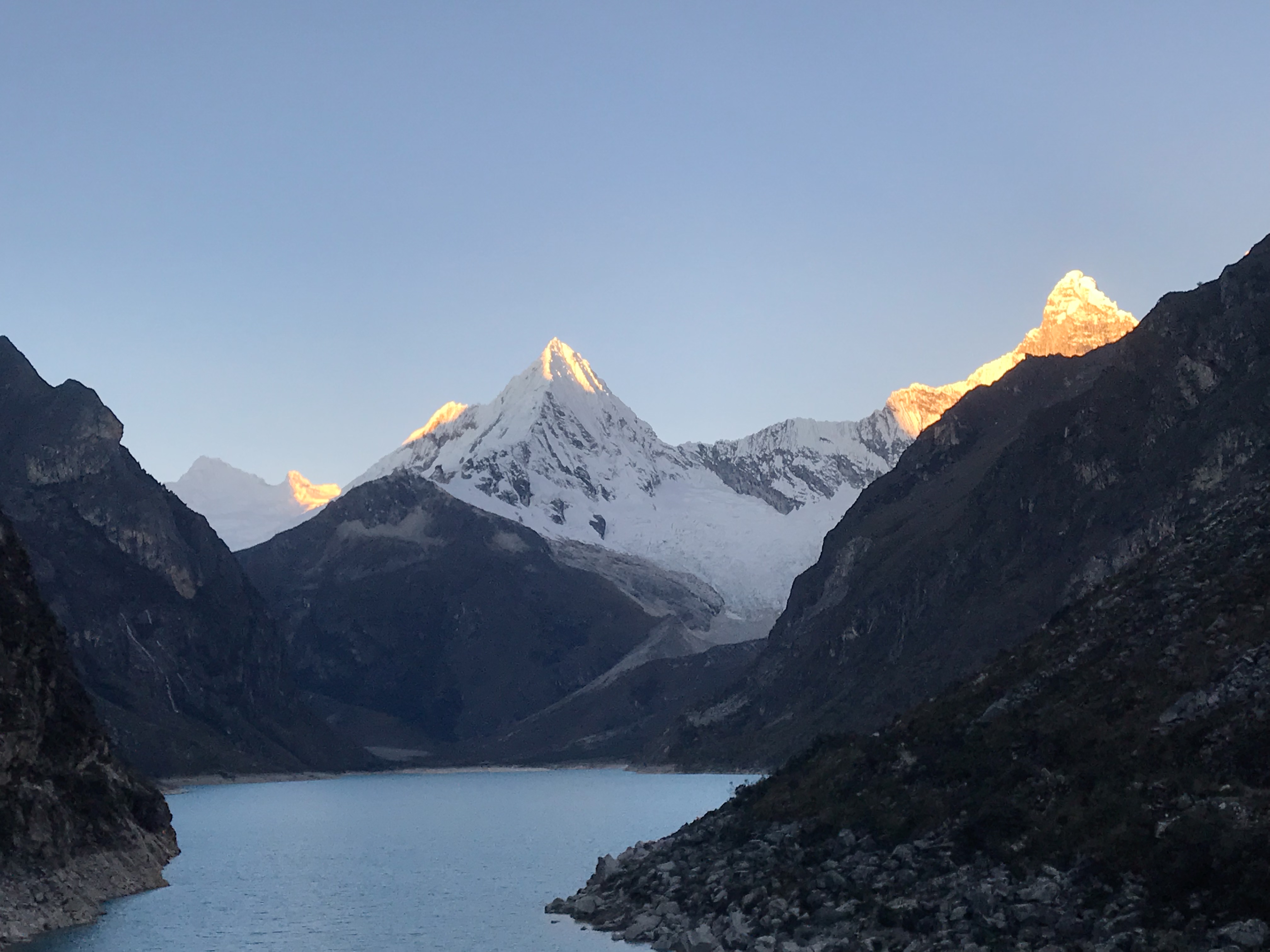
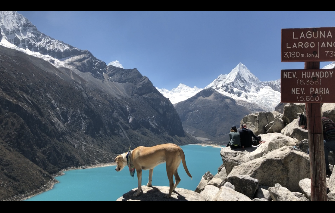
After climbing the twisty roads into the Andes we were ready to see the gem we had come to experience. Laguna Paron lies at about 14,000 feet elevation. It is a glacial lake, surrounded by some of the highest peaks in the Andes Mountains. We were able to camp right near the shore, and this was the view out the window of our slow house.
 No editing, no filters, no cell service, no crowds, no noise…… just unbelievable beauty! We spent the next days hiking around both sides of the lake with the dogs (yes, off leash dogs are allowed here). This was a beautiful way to spend the afternoon.


As the afternoon sun began to set, the colors of the lake and the surrounding mountains began to change. The shadows danced down the glaciers and the snowbanks were illuminated in new tones. It was a magical sunset at Laguna Paron. 


That night we used a couple of apps on our phones to look at the mountains around us. We were able to generate these two screen shots. One (maps.me) which showed our exact location, surrounded by very high peaks and gave the name to each one. The other app (World Peaks) shows each mountain and then gives info about that peak, including the height and our distance from it.

 We slept surprisingly well at this elevation. We anticipated some issues with altitude sickness, but because we approached over several days, we seemed to be okay. It was extremely cold (freezing) overnight. But once the sun was out, it was a beautiful morning. And again, we looked out the window to see this, just a few steps away from our home!
  So after coffee, dog food and breakfast sandwiches we were off to the mirador hike. This one is a little more strenuous and takes a couple of hours. The dogs were ready to go and so were we!


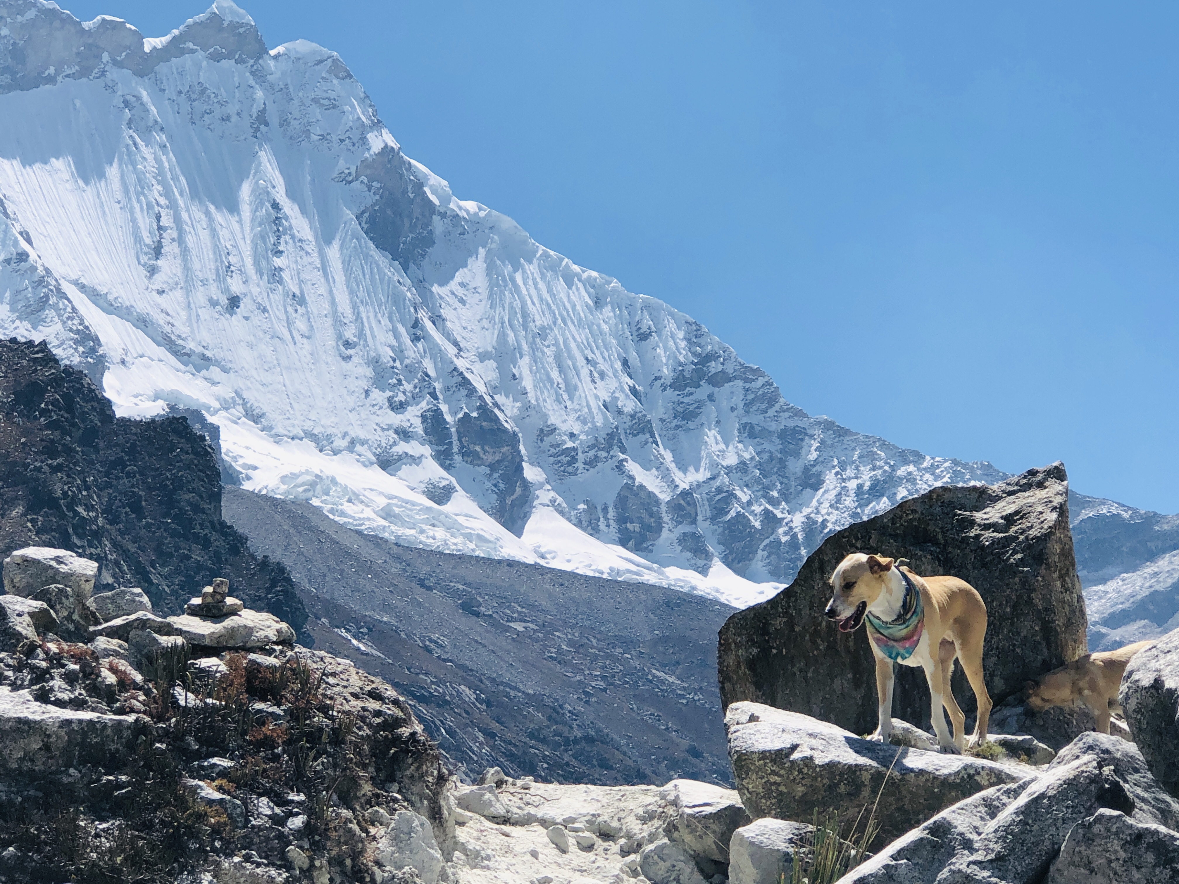
We finally reached the top of the climb. The dogs acted as if the elevation had no impact on them, but we humans felt it for sure. We were out of breath, a little sore and each holding a slight headache. But all that was irrelevant compared to the views from up there! 


We returned back to the camper and decided to drive down to lower elevation. The hike had taken its toll on us and we didn’t want to risk a miserable night with no sleep, fighting the other symptoms. So we took one last photo and turned toward lower ground. 
Of course, any good adventure such as this, ends with a car wash and a flat tire. We were able to take care of both in the nearby city of Caraz. 

Then we found a lovely, grassy camping area to spend a few nights and reflect on the beauty and extremes of the Cordillera Blanca. Pacha enjoyed relaxing in the grass as she learned to chew on a rawhide bone. 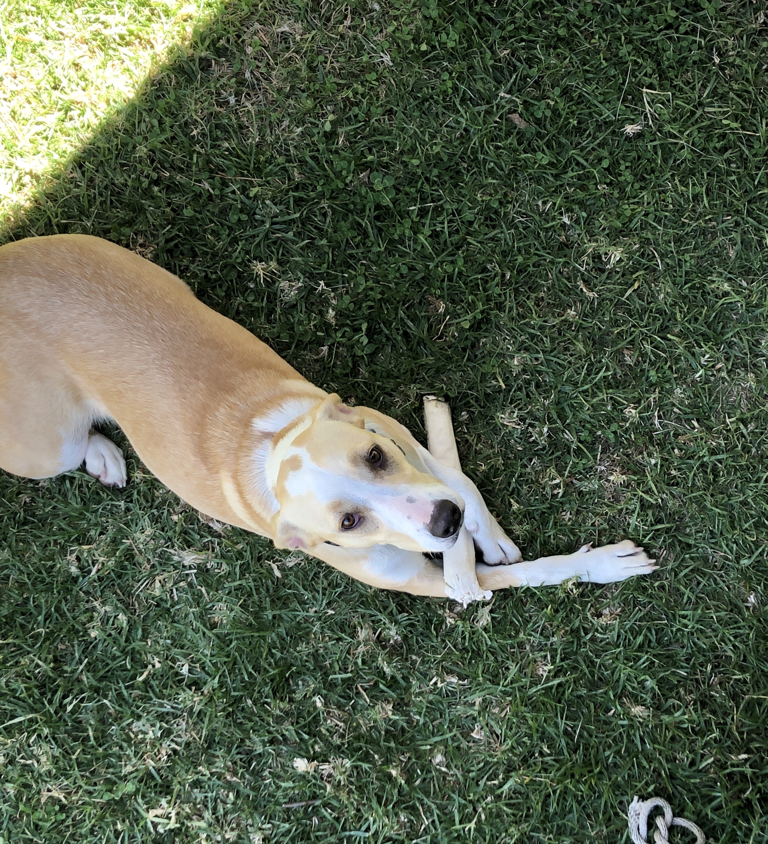

That was absolutely the most wonderful place you’ve been yet. I was mezmerized
Incredibly beautiful. We love how quickly you can change ecosystems and are able to share the beauty in each one. Thanks for the cultural connections as well. Don’t lose the soapbox.
Such penetrating beauty…still largely unspoiled because it is hard to get there! Those classic u-shaped glacial valleys….that copper blue water. Wow. Thanks.
Outstanding pictures !!!
Envy your discoveries.
Good luck for the future travels.
Great pictures!!