According to Canadians, The Top of the World is right here in the Yukon. It is a stretch of highway that runs along mountaintops and ridges.  When the clouds lift you can see for kilometers and kilometers. (That’s Canadian for miles and miles) Actually, the distance is so vast that it is nearly impossible to understand it with the human eye. And a camera lens does it no justice.
Driving the Top of the World Highway is similar to the Dempster Highway (see previous post), with more potholes. It is sort of a mucky, sticky game of “whack-a-mole” as the tires bounce in and out of each hole. There are no moles. There are no buildings. There are no humans. There are only ptarmigans here and there. But the potholes are unavoidable and the views are unending.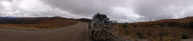 This “highway” closes in three weeks and remains closed until next summer. We made it before the first freeze. But it is rainy, drizzly, muddy and threatening to snow.
Then suddenly there is a cluster of small buildings. Two flags fly side by side. The agent greets the van and makes small talk. Then asks the requisite questions. Limes are surrendered. Turnips are spared. 
And the road continues, but now we are in Alaska, USA.


Awesome! I hope to do what you’re doing someday soon. Be safe.
It’s okay with the limes. Too late for G&T’s anyhow. It is going to get cold there quickly unless you’re near the coast!